
NATIONAL PARK
Oluklu Canyon – Doangbey Canyon
Track Name: National Park -Oluklu Canyon Doganbey Track
STARTING POINT: Dilek Peninsula Oluklu Canyon (15 m) or vice versa Doganbey Neighborhood (100 m) The highest crossing point is Karakol Pass which is 692 meters.
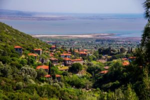
ENDPOINT: The village of Doganbey (Dimatoe).
DIFFICULTY LEVEL OF THE TRACK: Itis a 15 km long track of medium difficulty.
FEATURE OF TRACK:
4 -5 km of the track is in the canyon botanical road, 5-6 km in the forest stabilized road, the rest of the Dilek Peninsula in the southern part of the Doganbey neighborhood between the pine and maquis forest path and paths in the form of descent.
RESTING PLACES:
The first break takes place in the canyon pool, the second break is in the fountains near the summit, and the third break takes place on the southern slope of the Dilek Peninsula where Buyuk Menderes Delta looks great.
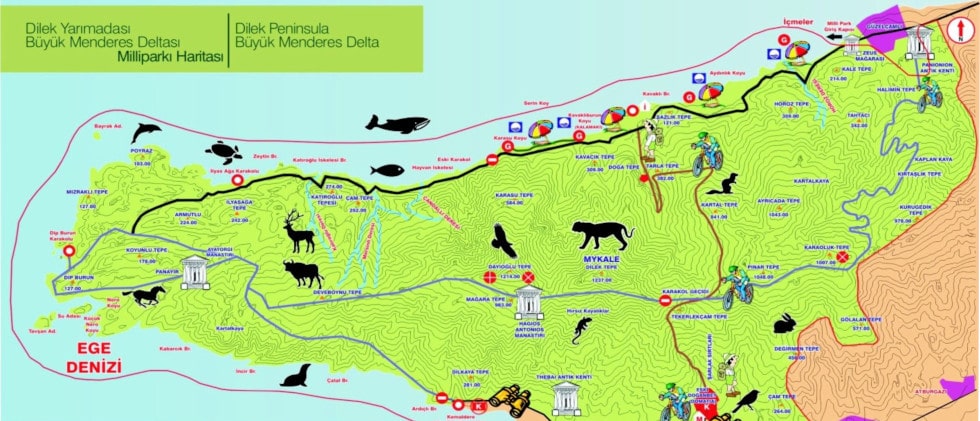
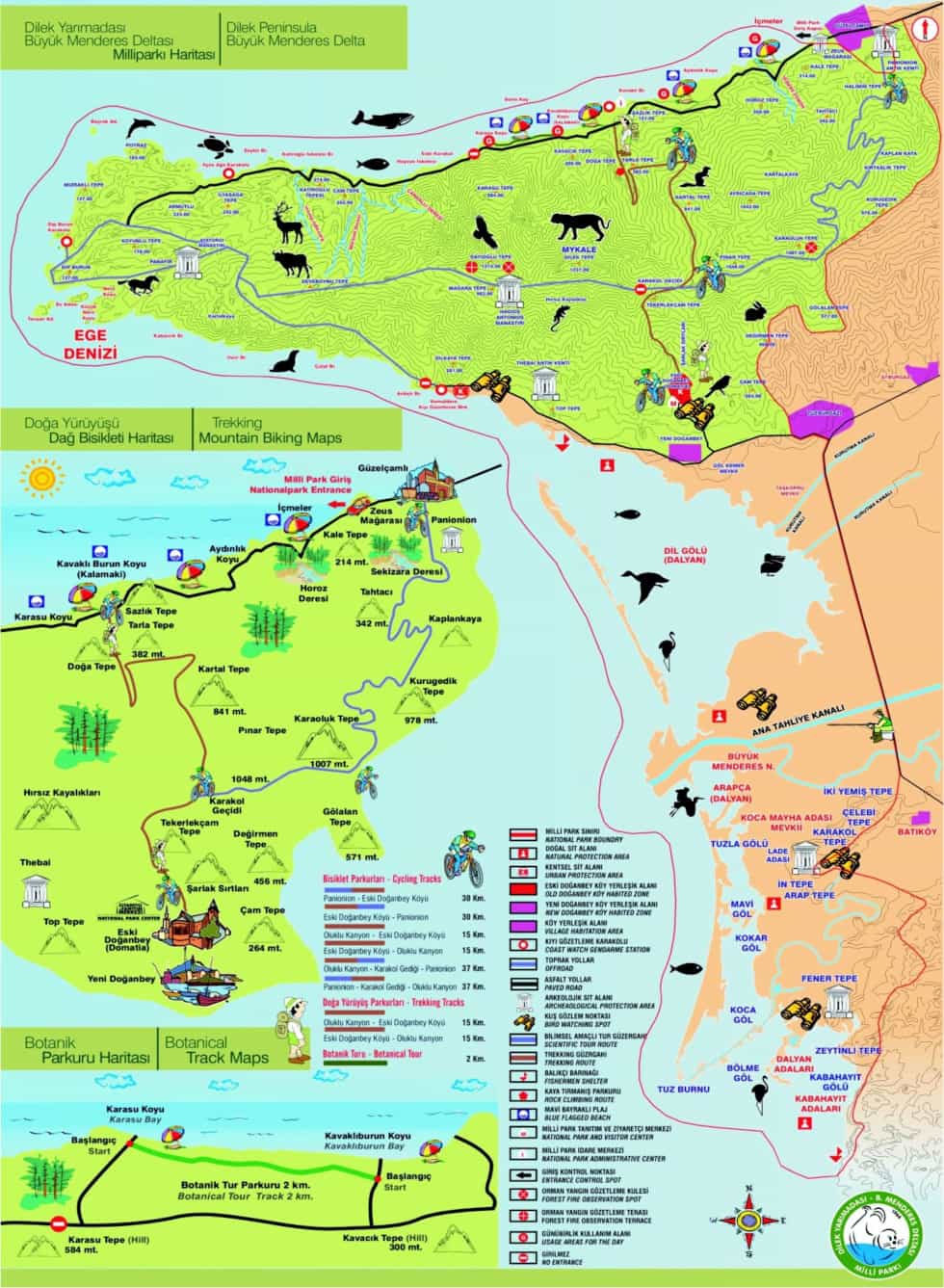
THINGS TO SEE
Guzelcamli National Park is located near the third bay. The steep cliffs that reach 500-600 meters along the canyon may astound you. On the one hand, you may encounter many endemic species while watching the steep cliffs. While climbing, you can see Kusadasi Bay and Samos Island from Greece.
Dilek Peninsula, which was declared a national park in 1996 and a total of 10 thousand 985 hectares of surface area to the authentic is among Turkey’s most important natural heritage of the fauna and flora Buyuk Menderes Delta, a wetland integrated with Lake Bafa is part of the field. This integrated system is internationally important due to its biodiversity, endangered species and endemic species, but is protected by international agreements such as the Ramsar Convention, the Bern Convention, the Rio Convention and the Barcelona Convention. Dilek Peninsula is important in terms of containing elements of Mediterranean Flora Region and elements of European Siberian Flora Region. Due to this unique diversity, Dilek Peninsula National Park was accepted as the “Flora Biogenetic Reserve Area” by the Council of Europe.
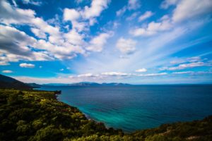
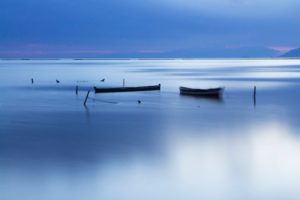
Dilek Peninsula coasts are one of Turkey’s most scenic coastal clean coasts. These coasts are also a natural habitat for Mediterranean monk seals, one of the rare mammal species in Europe. It was found by the researchers that the caves on the southern coast of the Dilek Peninsula are still used by the Mediterranean monk seals. In order to benefit from its clean sea and lush forests, Dilek Peninsula National Park, which has been flooded with visitors throughout the year, organizes jeep safaris, horse safaris and botanical tours in various trails. Sea meadows, which are an indication that the sea is clean, are found around the peninsula. The peninsula is the last point where the Anatolian Parsi, supposedly extinct, lives in the west. In the delta, which belongs to 95 families and has 30 endemic species, approximately 250 bird species live; Snowball them in few places in the Anatolian chestnut forests and part of the North Anatolian Turkey, Phoenician Juniper, Cypress and Quercus ilex is the only place he grew up in small communities.
In Buyuk Menderes Delta, sporting angling and bird watching are performed on the evacuation channel and Buyuk Menderes river. Located within the borders of the National Park; Cultural tours are organized to the ancient cities of Priene and Miletus, close to the ancient village of Eski Doganbey (Domatia), the ancient ancient city of Tebai, and the National Park, an open-air museum that exhibits the finest examples of Greek and Turkish architecture.
It is common for a wild boar or a deer to come up in front of you during the walk. In spring, pay particular attention to the Hairy Campanula. It is an endemic plant and its unauthorized plucking is prohibited.
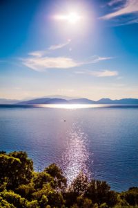
After crossing the peninsula, which is about 700 meters high, you will see, as Herodotus said, En The Most Beautiful Earth Under the Sky.. The Great Menderes Delta, the ancient city of Miletus, will be at your feet. At the end of the walk, you can enjoy tea in the old Greek village of Doganbey. If you’re very hungry, 10 km west of Karina, fish pleasure will help your fatigue.
You can also walk from opposite the route. This time you can start from Doganbey and finish at the entrance of the National Park canyon beach.
TRANSPORTATION: Sea and land transportation is provided. The entrance to the national park Güzelçamlı is 26 km to Kusadasi, 22 km to Söke, 70 km to Aydın and 130 km to İzmir Adnan Menderes Airport. If you do not have a vehicle, the city buses minibuses provide constant transportation convenience.
LOGISTICS SUPPORT:
Gendarmerie in Guzelcamli: 0 256 208 29 96
Karina gendarmerie 0 256 646 10 79
Doganbey village Gendarmerie 0256 20829 97
Note: Permission is required from national park attendants for the event.
Not: Etkinlik için Mili park görevlilerinden izin alınması gerekmektedir.